The purpose of this project is the drafting of the Study of Alternatives for the location of land for industrial use in Montemayor; reflected by obtaining various cartographies; in order to to ensure that the municipality has a suitable, coherent and feasible industrial land location and to ensure the growth of the municipality. The new land will allow companies to develop their activities, which will result in the growth of their economy and the creation of new jobs.

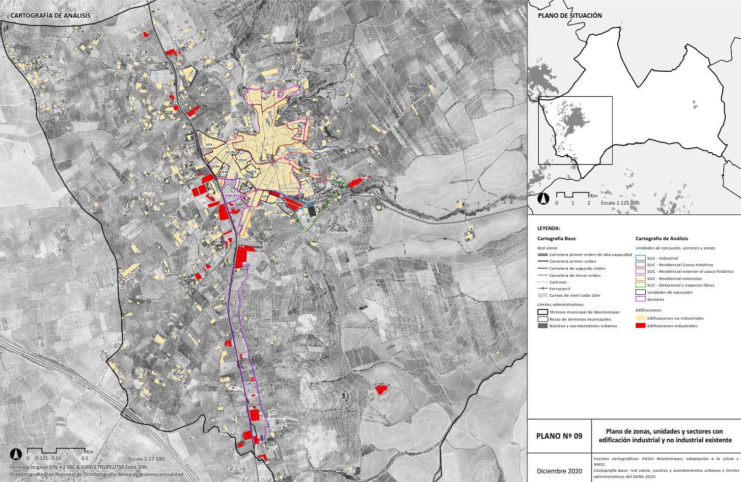
Cartography of Zones, Units and Sectors with Industrial and Non-Industrial Construction
In order to do so, they had to analyse the industrial land currently classified for this use in order to assess its situation and capacity for management and implementation, with the aim to: revalidate the planning proposal, weigh up its necessary adjustment or consider the location of new industrial land that is more suitable than that contemplated in the current planning and finally determine the most suitable locations and outline the one that is of most interest to the municipality in urban planning terms.

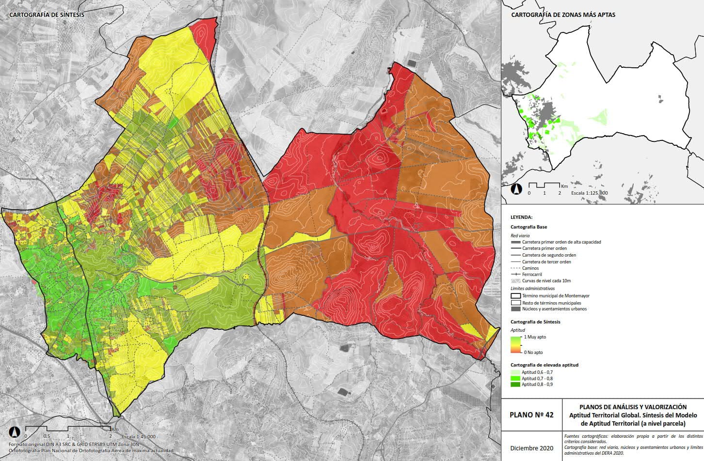
Land Suitability Model Synthesis Mapping

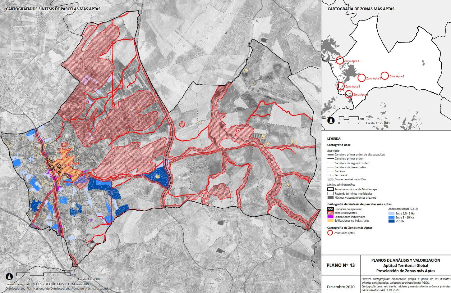
Pre-selection mapping of the most suitable areas
The Preliminary Study concluded with the urban definition of the most advantageous option for the municipalityThe project will include a detailed description of its scope, urban development parameters, forecast urban development costs, forecast of reinforcements or new general infrastructure systems and their cost, and definition of the urban development actions that may be necessary for its materialisation.

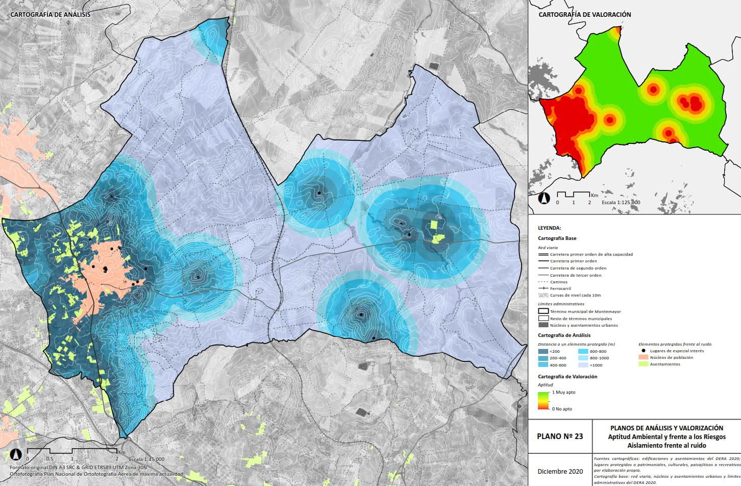
Noise Isolation Mapping
Correo electrónico: info@gis4tech.com
